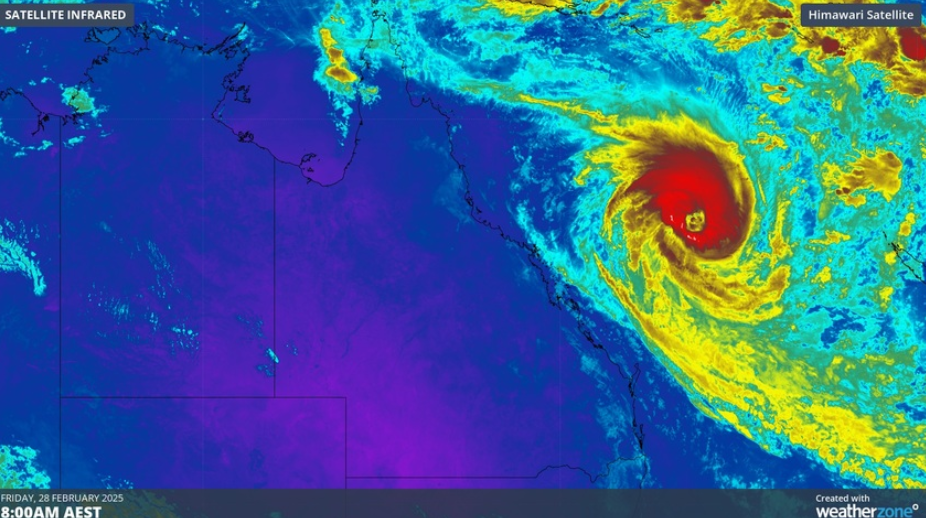
The cyclone is expected to move towards the coast today, before moving southeast tomorrow and Monday.
Severe Tropical Cyclone Alfred is inching closer to the Queensland coast, bringing intense winds and wild surf.
The system remains over the Coral Sea, with the Bureau of Meteorology forecasting strong to gale-force winds across the southern Great Barrier Reef Islands and extending to K'gari this weekend.
Bureau of Meteorology senior meteorologist Jonathan How said yesterday there was "high confidence" the cyclone would remain well offshore over the next two days.
READ MORE: European leaders pledge to stand by Ukraine after heated clash
The cyclone is expected to move towards the coast today, before moving southeast tomorrow and Monday.
It's expected to be slow-moving by Tuesday before shifting back towards the southern Queensland coast by the middle of next week.
A severe weather warning remains in place for parts of the Capricornia, Wide Bay and Burnett and Southeast Coast Forecast Districts.
"Alfred is producing a large area of gale force winds on its southwestern flank, and there is a risk the system may approach close enough to the coast to produce a period of gales and damaging wind gusts about the coastal fringe overnight tonight and during Sunday," the Bureau said.
READ MORE: 'We stand with Ukraine': PM speaks after Oval Office clash
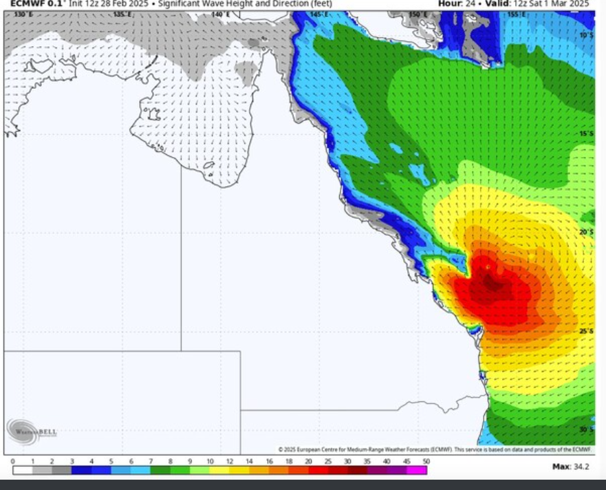
A separate coastal hazard warning is also current for the Wide Bay and Southeast Coast of Queensland.
Locations which may be affected include Bundaberg, Gladstone, Hervey Bay, K'gari, Miriam Vale and Rainbow Beach.
Coastal and island communities along the southern Queensland and northeast NSW coast have been urged to monitor conditions.
DOWNLOAD THE 9NEWS APP: Stay across all the latest in breaking news, sport, politics and the weather via our news app and get notifications sent straight to your smartphone. Available on the Apple App Store and Google Play.
 Catastrophic blow-up could be most significant turning point in European history since 1945
 Former youth basketball coach charged with more child abuse offences
 Trump expected to sign order making English the official language of the US
 Gene Hackman likely dead for nine days before discovery, pacemaker shows
 Teenage girl charged after allegedly stabbing security guard in Melbourne
 World leaders turn their back on Trump after Zelenskyy meeting
 Trump demands Zelenskyy make immediate ceasefire with Russia after fiery meeting
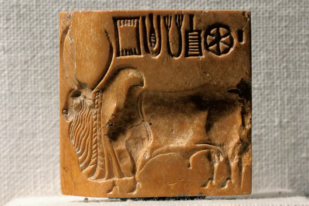 Win $1m if you can crack the meaning of this ancient code
 Worlds former tallest and fastest roller coaster comes down in implosion
 Zelenskyy told to leave after catastrophic shouting match with Trump
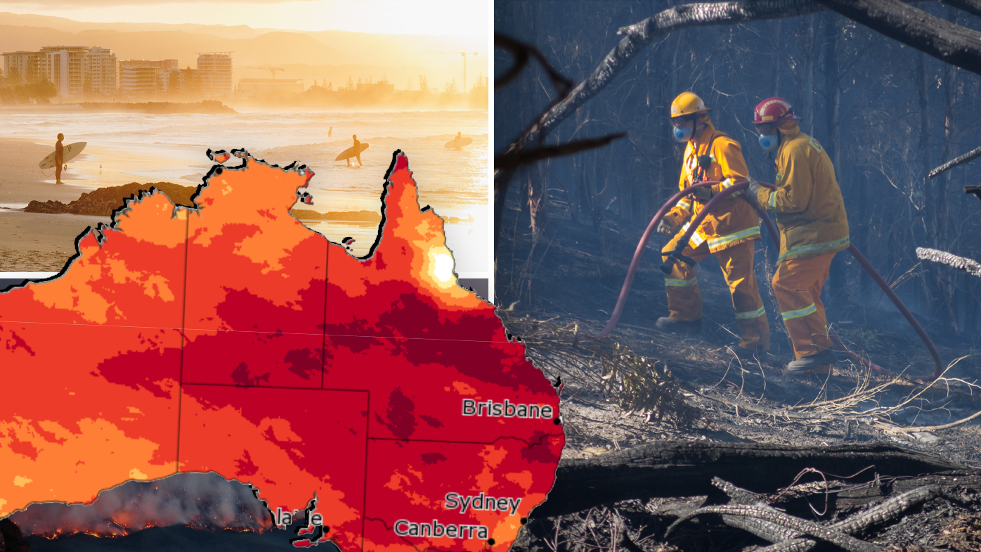 Hot with a chance of bushfires: The weather you can expect in autumn
 Worker wrestles with chainsaw thief during brazen robbery
 Beaumont search team accused of 'preposterous' smear campaign
 Just five days of overeating impacts long-term habits, study finds
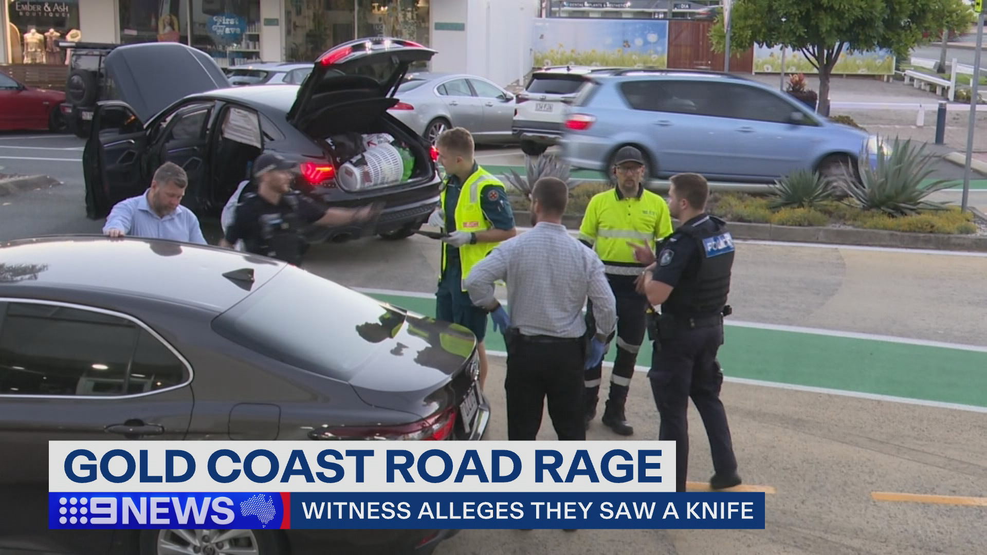 Passengers and drivers involved in Gold Coast crash flee scene
 'Complete disappointment': Backlash over release of Epstein files
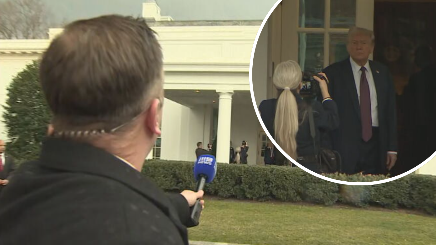 A question of AUKUS: 9News reporter doorstops Trump outside White House